
Mad River Glen
Mad River Glen is a ski area like no other. It’s a place where skiing is still a sport, not an industry. A place where skiing remains an outdoor adventure…

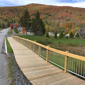
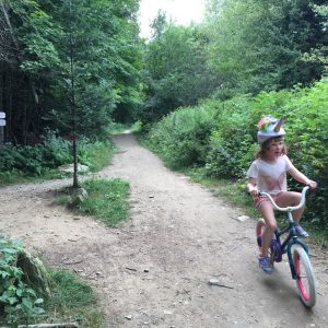
Mad River Path – Mad River Park
Recreational fields with a 0.5 mile walking and running path, picnic area and memorial benches for the public to use and enjoy. Formerly a quarry and an airfield for small…

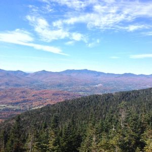
Long Trail: Lincoln Gap to Mt. Abraham
The Lincoln Gap to Mt.Abraham portion of the Long Trail is a challenging hike to one of the most impressive summits in New England. At over 4000 feet you have…
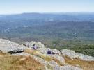
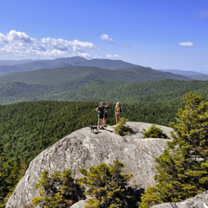
Long Trail: Sunset Ledge
The Sunset Rock hike is relatively short hike that quickly takes the participant to absolutely spectacular views of the Valley and the Adirondack Mountain Range from an elevation of over…
Camel’s Hump via Monroe Trail (Duxbury)
This challenging and spectacular 7.4 mile round-trip hike takes you above the trees to the 4,083′ summit of Vermont’s highest undeveloped peak. You hike through birch, beech, and maple forest…

Camel’s Hump from Huntington
A lesser-used 5.6 mile round-trip loop trail to the summit of Camel’s Hump approaches the mountain from the west. The Forest City Trail begins at a road junction east of…
Long Trail: Stark Mountain and Mount Ellen
A 9.3 mile out and back hike through forest across the top of Mad River Glen to the summit of General Stark Mountain and then on to the summit of…

Long Trail: Molly Stark’s Balcony
A 2.4 mile round-trip hike that gains over 500′ of elevation to a unique lookout. From Rt. 17 you hike north on the Long Trail, which climbs steeply, passes a…

Bragg Hill Road Walk
Moderate, 4 mile loop, elevation gain 850’ (paved and dirt roads) Bragg Hill Road has few panoramic rivals in the Valley. The mountains are so close, you can almost touch…
Burnt Rock Mountain
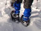
A steep, 5.2 mile round-trip snowshoe that takes you up to some of the best viewing on the Long Trail. The trail begins at the parking lot at the end…

Phen Basin Trail
The trail begins at the Battleground Condominiums. It is about 4 miles out and back but can be made longer by connecting to the Catamount Trail which then crosses the…

Long Trail: Gap to Gap (Monroe Skyline)
A full day, or overnight, and 11.6 miles along the Long Trail will take you to the Summit of Mount Abraham, across the top of Lincoln Peak, Mount Ellen, and…

Mad River Path – Kingsbury Greenway
Kingsbury Greenway – The greenway is an easy/intermediate 2.5 mile round trip path heading north along the river. From its southern terminus at the Riverside Conservation Area, the path crosses…
Mad River Path – West Greenway Path
The West Greenway is an easy 2.3 mile (out and back) trail. It is a charming path along the Mad River with beautiful vistas of the mountains and farm fields.…

Long Trail: Mt. Abraham via Battell Trail
Challenging, 5.8 miles out and back, elevation gain 2500’ One of Vermont’s five 4,000’ mountains, the rocky summit of Mount Abraham offers 360 degree panoramic views of the White Mountains,…
Mad River Path – Kingsbury Farm Path
Kingsbury Farm Path – The Kingsbury Farm Path heads north and is an easy 1 mile trail (out and back) traveling between a riparian buffer and farm fields to its terminus…
Mad River Path – Spaulding Greenway
This 1-mile section of the Mad River Path network is flat and easy and offers mountain views. The Spaulding Greenway follows the outside edge of an active farm field and along…

Mad River Path – Wait’s Way
A flat and easy.5 mile ou and back path. Wait’s Way tucks behind the elementary school and along the river to the north of the General Wait House. It is a…
Mad River Path – Hosford’s Heart of the Valley Trail
A pathway that connects the historic Waitsfield Village to the towns commercial center and provides access to the Mad River. The Hosford Heart of the Valley Trail, named after community…
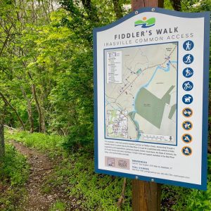
Mad River Path – Fiddler’s Walk
A short walk connecting Irasville Common to the banks of the Mad River. This moderate trail connects Irasville Common to Fiddler’s Green along the Mad River. It passes by the Irasvile…
Mad River Path – Austin Walk
A short walk in the riparian zone of the Mad River along with access to the Lareau Swimming Hole. Austin Walk starts at the north end of the parking lot and…

Mad River Path – Mill Brook Trail
A hiking trail through many types of forests with connections to other trail systems. The Mill Brook Trail is a hiking oriented section of the network with sometimes steep, rocky,…
Mad River Path – Yestermorrow Path
A short path that winds along the edge of a beautiful meadow and through the Yestermorrow Building and Design School campus. This 1/3 mile mostly grassed section connects the Kingsbury…

Mad River Path – Warren Path, Vista Trail and Interpretive Trail
A network of easy to advanced trails through forests studded with rock outcrops and boulders. The Warren Path & Interpretive Trail provide recreation hiking opportunities starting at Brooks Field. Warren…

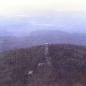
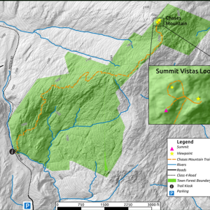
Boyce Town Forest Trail
A gentle 1.2 mile round trip hike where you will hike up an old road through alpine meadow to gentle peak with 270-degree view. Can see Mad River Glen, Mt.…
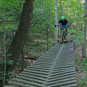
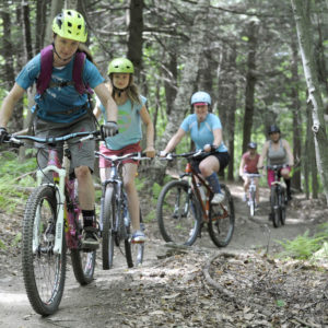
Blueberry Lake Trails
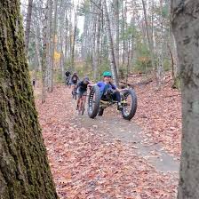
The Blueberry Lake trails are multi-use trails that are most popular for hiking and mountain biking. They were designated in 2013 as an International Mountain Bike Association Model Trail-Gateway network…

Scrag Mountain Trails
The out and back trail to the beaver pond near the summit of Scrag Mountain is 4.2 miles in length. This 750 acre forest, owned by the Town of Waitsfield,…

Wu Ledges Trails
Please note that parking at the trail head is exceedingly limited (only 2 spots). Please respect the homeowners property when parking. There are three main trails at Wu Ledges. A…
Burnt Rock Mountain
A steep, 5.2 mile round-trip that takes you up to some of the best viewing on the Long Trail. The trail begins at the parking lot at the end of…
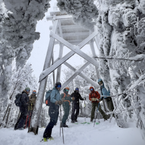
General Stark Mountain via Stark Mountain Trail
The Stark Mountain Trail is 2.5 miles to the summit or 5 miles round trip. with a 2,036’ of vertical gain. This trail follows a wide, well established, “work road” up to…
Mount Hunger via Waterbury Trail
The Waterbury Trail is a 5 mile out and back trail that takes hikers up through C.C. Putnam State Forest to the summit of Mount Hunger. The ascent is steady…
Spruce Mountain
Spruce Mountain is located in LR Jones State Forest, the oldest State Forest in Vermont. The 2.2 mile trail to the summit of Spruce Mountain, a 3,037 foot peak, climbs…

Little River State Park and Cotton Brook Trails
Suggested Trails in the Little River State Park Network Dalley Loop Trail The trail follows an old logging road through the forest, over small brooks, and past the remains of…

Moretown Town Forest
This relatively small 2.5 mile multi-use trail system is popular among hikers and mountain bikers. The network can be accessed from either the Moretown Elementary School parking lot or from…
Middlesex Town Forest
The Middlesex Town Forest has a small network of trails. You can hike up the Notch Road, a class 4 dirt track that runs for 0.7 miles one-way. For a…

Howe Block – Camel’s Hump State Forest
An array of trails that emanate efrom the top of Tucker Hill Road leading to the Mad River Valley Recreation Hub, downtown Waitsfield and Lareau Farm.
Millstone Trails
The Millstone Trails are network of multi-use trails traversing the historic quarry lands of Millstone Hill. The trails wind their way through northern hardwood and coniferous forests and along exposed…
Perry Hill Trails
Arguably offering up some of the finest trails in the state. Packed within this 10-mile network there is something for everyone. Want to try your hand at some classic tech…
Rochester Valley Trails
The Rochester Valley Trails boast great variety accessing multiple views of the narrow RT 100 valley through public and private lands. You can expect sections of the network to be…
Randolph Trails
The Randolph Trails are an expansive network consisting of roughly 20 miles through Randolph and Braintree on private and public land. The trails range from a two mile flowing machine…
Cady Hill Town Forest
Cady Hill Forest is STP’s flagship trail network; its diverse terrain, great views, easy access from Town and the Stowe Rec Path, and trails that cater to just about any…
Bolton Valley Backcountry
With its expansive views of Lake Champlain, Bolton faces directly west across the widest part of the lake and lies right in the middle of the front range of the…